So, if you don’t have a PushTo, GoTo or a Telrad (like myself), this is whatcha gonna need for some old-skool style star-hopping.
Gear
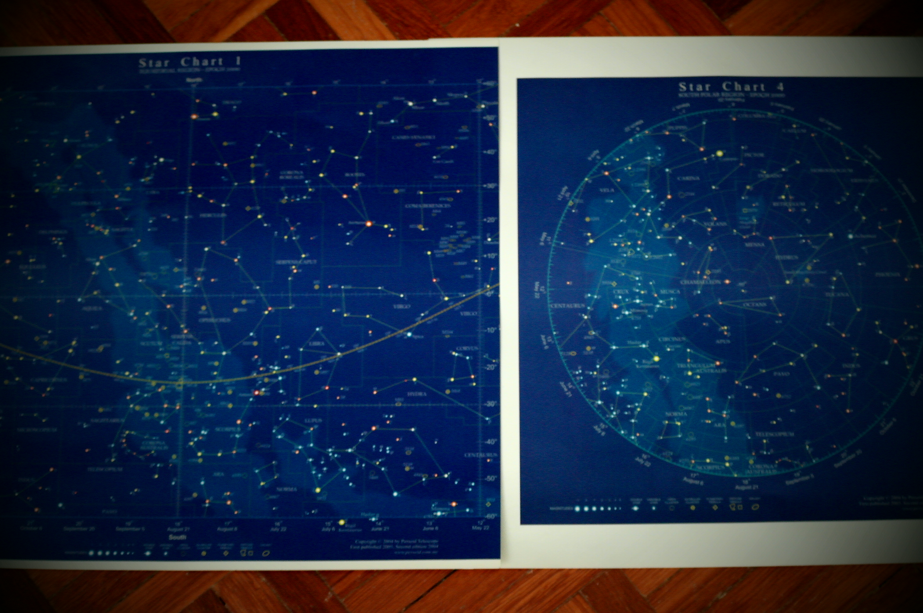
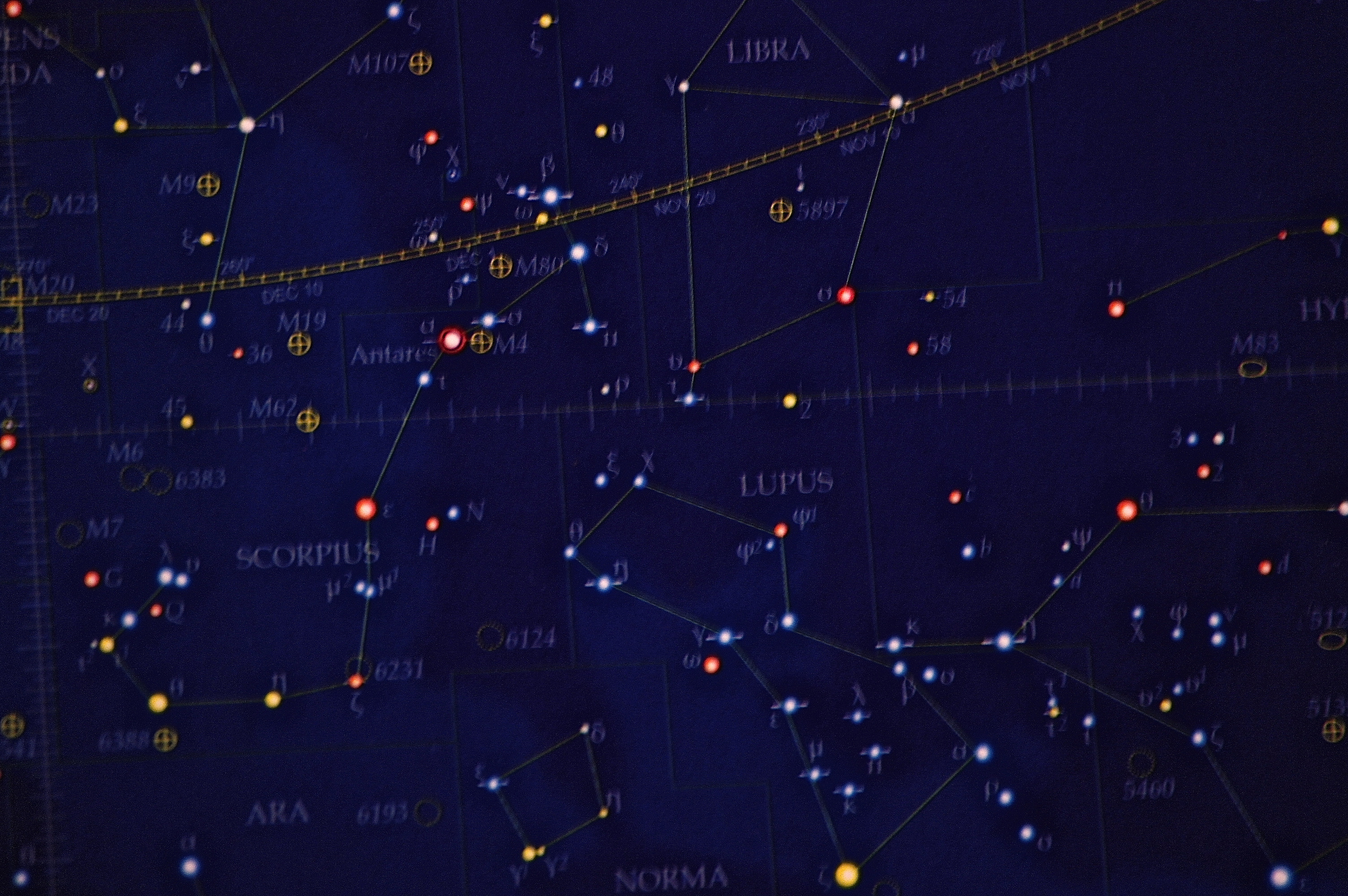
Star Chart
Here’s a link to a free downloadable version which I’ve used for my observation nights with my club: SFA Star Chart. Star Charts map constellations, nebulae and galaxies, and they sometimes even indicate brightness! So, before you start observing, you’ll need a star chart to know what’s up in the sky tonight, decide which object to hunt for and use the pattern of stars to guide you there. Without star-hopping, locating an object is like looking for a needle in a haystack – especially if your eyepiece has a narrow field of view and a short focal length – talk about tunnel vision!

Hands

A Compass
Instructions
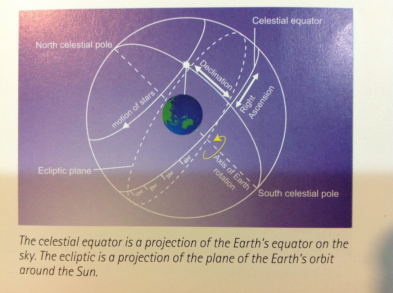
The trick is to imagine your star chart as a sphere encapsulating Earth.
From the Equatorial Region
Check your Star Chart and lookout for today’s date (its on the horizontal axis). If you imagine a vertical line through the point which marks the date, that would be the view of the skies at the Celestial Meridien at 8 pm. Then on, just minus or add the time of your viewing to the Meridien (at 8 pm) and shift your focus (the imaginary vertical line) on the map – basically, aligning the Celestial Meridien to the current time. So, if you’re observing at 11pm, you would need to add 3 hours (11-8=3) to the 8pm Meridien, which means, looking 3 hours to the left of the imaginary 8pm Meridien line on the map. if you’re observing at say 7 pm, look an hour (8-7=1) to the right of the 8pm Meridien. Once you’ve approximated your vertical axis, look up to the skies and align it with what you see.
Now if you wanna see the Eastern sky, align yourself to face East – here’s where the compass comes in. Look at the left of the vertical line which matches your time of viewing and date. And if you want to see the Western sky, face West and look at the right of the imaginary line. You see, as Earth rotates, you’ll see new stars emerging on your East and other stars falling under the Western horizon.
It all may sound quite confusing. So, back to basics, imagine your chart as a sphere wrapped around Earth, and remember how Earth’s rotation makes the sky look like its moving. Check out: Why Stars Move
Next up, is using your hands. Once, you’ve located what you see on the chart, to hop to the right star, you’ll need to measure. On the chart, are “latitude lines” 10 degrees apart. How on earth would you know what’s 10 degrees apart in the sky. Well, make a fist and point it up to the sky, the length of a fist measures 10 degrees in the sky. The thumb, about 5 degrees. And if you open you hand as wide as possible, from the tip of the little finger to the thumb’s tip, 25 degrees.
Now, you’re all set!

- Zoomed in Star Chart
ps. What’s the Celestial Meridien?It’s a circle the passes through the north and south celestial poles, the zenith and nadir. Read: Measuring the Sky to find out more.